Scenario : you need to create a rectangle in leaflet based on a point for which you know the long / lat.

function DrawRectangle(lat, lng) {

        var km = 12;

        // number of km per degree = ~111km (111.32 in google maps, but range varies  between 110.567km at the equator and 111.699km at the poles)
        // 1km in degree = 1 / 111.32km = 0.0089
        // 1m in degree = 0.0089 / 1000 = 0.0000089
        var coef = km * 0.0089 / 2;

        var latref = lat;
        var lonref = lng;

        var mx_lat = latref + coef;
        var mxm_lat = latref - coef;
        var mx_lon = lonref + coef;
        var mxm_lon = lonref - coef;


        var southWest = L.latLng(mxm_lat, mxm_lon),
            northEast = L.latLng(mx_lat, mx_lon),
            bounds = L.latLngBounds(southWest, northEast);

        var rect = L.rectangle(bounds).addTo(map);
        group.addLayer(rect);
    }
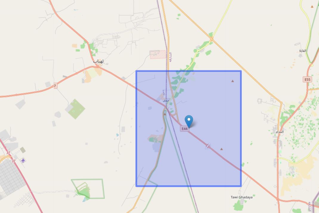
I realized that above is not exactly a square and below is the one which draws a square from circle.
    function DrawCircle(lat, lng) {

        var circle = L.circle([lat, lng], {
            color: "red",
            fillColor: "#f03",
            fillOpacity: 0.0,
            radius: 6000.0
        }).addTo(map);
        group.addLayer(circle);
        var rectangle = L.rectangle(circle.getBounds(), {
            stroke: false,
            fill: true,
            color: '#00f',
            opacity: 0.1
        }).addTo(map);
        group.addLayer(rectangle);
    }